Home > Fine Art Storehouse > Map
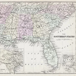
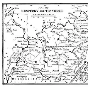
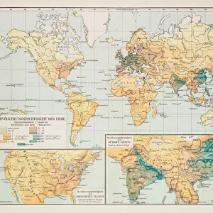
Western States 1852 Map

![]()
Wall Art and Photo Gifts from Fine Art Storehouse
Western States 1852 Map
Unleash your creativity and transform your space into a visual masterpiece!
benoitb
Media ID 13666897
© benoitb
Color Swatch Geographic Map Illinois Indiana Kentucky Lake Erie Lake Michigan Line Art Missouri North America Ohio Sketch State Tennessee The Americas Us State Border Western Usa Classical Style Drawing Art Product Painted Image Retro Styled Victorian Style
FEATURES IN THESE COLLECTIONS
> Fine Art Storehouse
> Map
> Historical Maps
> Fine Art Storehouse
> Map
> USA Maps
EDITORS COMMENTS
This print takes us back to the 19th century with its retro-styled depiction of the Western States in 1852. The artistry and attention to detail showcased in this cartographic masterpiece are truly remarkable. Painted with a classical Victorian flair, it exudes an air of antiquity that transports us to a bygone era. The artist's skillful use of line art and engraving techniques brings this illustration to life, capturing the essence of the physical geography of the region. From Lake Erie to Lake Michigan, every river and state border is meticulously depicted, making it both informative and visually stunning. As we gaze upon this enchanting piece, we can't help but marvel at how history unfolds before our eyes. It serves as a testament to the exploration and settlement of America's western frontier during a time when states like Illinois, Ohio, Indiana, Missouri, Tennessee, and Kentucky were still emerging. With its rich color swatches and intricate details carefully etched into each stroke, this print is not just a map; it is a work of art that encapsulates an important chapter in American history. Whether you're an enthusiast for cartography or simply appreciate fine craftsmanship from yesteryears, Benoitb's creation will undoubtedly captivate your imagination.
MADE IN THE USA
Safe Shipping with 30 Day Money Back Guarantee
FREE PERSONALISATION*
We are proud to offer a range of customisation features including Personalised Captions, Color Filters and Picture Zoom Tools
SECURE PAYMENTS
We happily accept a wide range of payment options so you can pay for the things you need in the way that is most convenient for you
* Options may vary by product and licensing agreement. Zoomed Pictures can be adjusted in the Cart.