Home > Europe > United Kingdom > England > London > Boroughs > Haringey
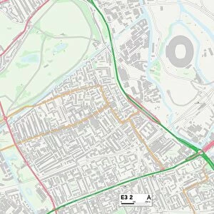
Haringey N17 7 Map

![]()
Wall Art and Photo Gifts from Map Marketing
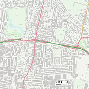
Haringey N17 7 Map
Postcode Sector Map of Haringey N17 7
Media ID 19976172
Balliol Road Butterfield Close Cambridge Gardens Carrick Gardens Church Lane Devonshire Gardens Devonshire Road Fenton Road Haringey Jellicoe Road Larkspur Close Lordship Lane Marshall Road Mayfair Gardens Norman Avenue Peregrine Road Stockton Road The Green The Roundway Walden Road White Hart Lane
FEATURES IN THESE COLLECTIONS
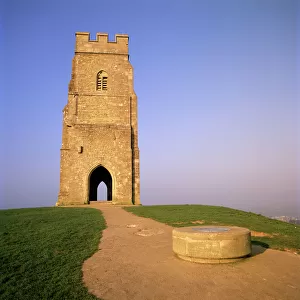
> Architecture
> Towers
> Churches
> Europe
> United Kingdom
> England
> London
> Boroughs
> Haringey
> Map Marketing
> Postcode Sector Maps
> N - London N
> Maps and Charts
> Related Images
MADE IN THE USA
Safe Shipping with 30 Day Money Back Guarantee
FREE PERSONALISATION*
We are proud to offer a range of customisation features including Personalised Captions, Color Filters and Picture Zoom Tools
SECURE PAYMENTS
We happily accept a wide range of payment options so you can pay for the things you need in the way that is most convenient for you
* Options may vary by product and licensing agreement. Zoomed Pictures can be adjusted in the Cart.