Home > Africa > Chad > Related Images
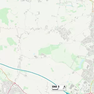
Staffordshire ST14 5 Map

![]()
Wall Art and Photo Gifts from Map Marketing
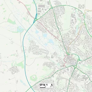
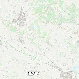
Staffordshire ST14 5 Map
Postcode Sector Map of Staffordshire ST14 5
Media ID 19981944
Abbey Close Abbey Road Alton Road Ashbourne Road Barnwell Close Bennetts Lane Birch Close Buckley Close Cedar Drive Church Croft Church Farm Church Lane College Road Coronation Crescent Dove Lane Eaton Road Fraser Drive Greenfields High Street Hollington Road Hook Lane Leigh Lane Linden Close Marlpit Lane Mill Street Narrow Lane Northfield Avenue Oak Road Poppyfields Rectory Road Rowan Close Rowan Court St Chads Close St Michaels Road Staffordshire Stocks Lane Taylors Lane The Orchard The Weavers The Yews Uttoxeter Road Verney Close Vicarage Drive Watery Lane West View Westgate Close Willoughby Close Woodland Drive Alders
FEATURES IN THESE COLLECTIONS
> Africa
> Chad
> Related Images
> Animals
> Birds
> Columbiformes
> Doves
> Related Images
> Europe
> United Kingdom
> England
> Staffordshire
> Alton
> Europe
> United Kingdom
> England
> Staffordshire
> Church Eaton
> Europe
> United Kingdom
> England
> Staffordshire
> Church Leigh
> Europe
> United Kingdom
> England
> Staffordshire
> Croxden
> Europe
> United Kingdom
> England
> Staffordshire
> Denstone
> Europe
> United Kingdom
> England
> Staffordshire
> Field
> Europe
> United Kingdom
> England
> Staffordshire
> Hollington
> Map Marketing
> Postcode Sector Maps
> ST - Stoke-on-Trent
MADE IN THE USA
Safe Shipping with 30 Day Money Back Guarantee
FREE PERSONALISATION*
We are proud to offer a range of customisation features including Personalised Captions, Color Filters and Picture Zoom Tools
SECURE PAYMENTS
We happily accept a wide range of payment options so you can pay for the things you need in the way that is most convenient for you
* Options may vary by product and licensing agreement. Zoomed Pictures can be adjusted in the Cart.