Home > Europe > United Kingdom > Scotland > Maps
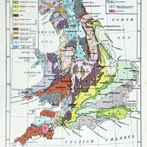
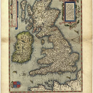
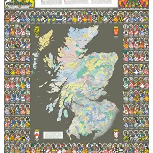
Geological map of the British Islands

![]()
Wall Art and Photo Gifts from Mary Evans Picture Library
Geological map of the British Islands
Geological map of the British Islands.
1941
Mary Evans Picture Library makes available wonderful images created for people to enjoy over the centuries
Media ID 23090632
© Mary Evans Picture Library/Onslow Auctions Limited
1941 Coded Coding Geological Geology Isles Maps Office Ordnance Survey
FEATURES IN THESE COLLECTIONS
> Animals
> Mammals
> Muridae
> Fortior
> Europe
> Republic of Ireland
> Maps
> Europe
> United Kingdom
> England
> Maps
> Europe
> United Kingdom
> England
> Posters
> Europe
> United Kingdom
> England
> Related Images
> Europe
> United Kingdom
> Maps
> Europe
> United Kingdom
> Scotland
> Maps
> Europe
> United Kingdom
> Scotland
> Posters
> Europe
> United Kingdom
> Scotland
> Related Images
> Europe
> United Kingdom
> Wales
> Maps
> Mary Evans Prints Online
> New Images August 2021
MADE IN THE USA
Safe Shipping with 30 Day Money Back Guarantee
FREE PERSONALISATION*
We are proud to offer a range of customisation features including Personalised Captions, Color Filters and Picture Zoom Tools
SECURE PAYMENTS
We happily accept a wide range of payment options so you can pay for the things you need in the way that is most convenient for you
* Options may vary by product and licensing agreement. Zoomed Pictures can be adjusted in the Cart.