Home > Europe > United Kingdom > England > Bristol > Lawrence Weston
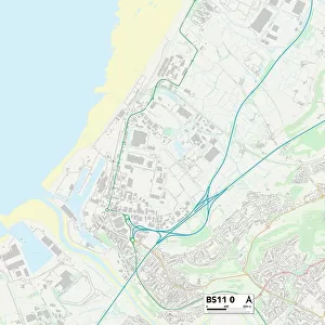
Bristol BS11 0 Map

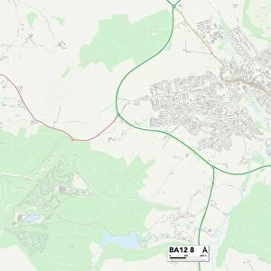
![]()
Wall Art and Photo Gifts from Map Marketing
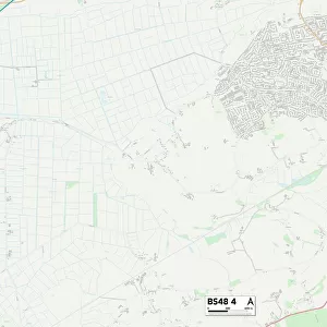
Bristol BS11 0 Map
Postcode Sector Map of Bristol BS11 0
Media ID 19966530
Bank Road Bristol Broadlands Drive Capel Road Chapel Lane Cornflower Close Elm Close Ferndown Close Fernhill Lane Greenhill Lane Hermitage Close High Street Jasmine Grove Kirkby Road Little Mead Lower High Street Mead Close Middleton Road Old Farm Close Old Park Road Orchard Crescent Park Hill Park Road Pembroke Road Priory Gardens Quarry Lane Teal Close The Green The Ridge Vincent Close Waverley Road Woodview Close Home Ground Shirehampton
FEATURES IN THESE COLLECTIONS
> Arts
> Artists
> B
> Banfield Banfield
> Arts
> Artists
> R
> Roman Roman
> Europe
> United Kingdom
> England
> Bristol
> Bristol
> Europe
> United Kingdom
> England
> Bristol
> Lawrence Weston
> Europe
> United Kingdom
> England
> Bristol
> Shirehampton
> Europe
> United Kingdom
> Wales
> Monmouthshire
> Caldicot
> Europe
> United Kingdom
> Wales
> Pembrokeshire
> Pembroke
> Map Marketing
> Postcode Sector Maps
> BS - Bristol
> Maps and Charts
> Related Images
MADE IN THE USA
Safe Shipping with 30 Day Money Back Guarantee
FREE PERSONALISATION*
We are proud to offer a range of customisation features including Personalised Captions, Color Filters and Picture Zoom Tools
SECURE PAYMENTS
We happily accept a wide range of payment options so you can pay for the things you need in the way that is most convenient for you
* Options may vary by product and licensing agreement. Zoomed Pictures can be adjusted in the Cart.