Home > Arts > Photorealistic artworks > Detailed art pieces > Masterful detailing in art
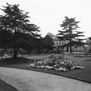
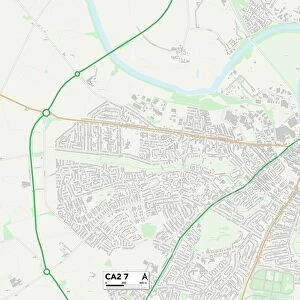
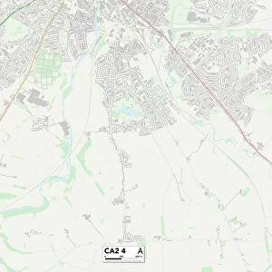
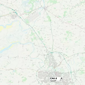
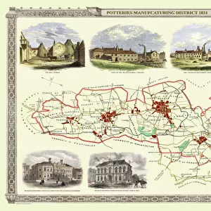
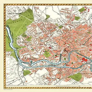
Old Map of Carlisle 1805 by Cole and Roper

![]()
Wall Art and Photo Gifts from MapSeeker
Old Map of Carlisle 1805 by Cole and Roper
An attractive and detailed early 19th century reproduction town plan of Carlisle 1805. First published by Cole and Roper as a finely engraved series of county maps and town plans which were initially issued in parts and then together as The British Atlas in 1810
Welcome to the Mapseeker Image library and enter an historic gateway to one of the largest on-line collections of Historic Maps, Nostalgic Views, Vista's and Panorama's from a World gone by.
Media ID 20348078
© Mapseeker Publishing Ltd
Cole And Roper Historic Map Old Town Plan Town Plan Carlisle
FEATURES IN THESE COLLECTIONS
> Arts
> Photorealistic artworks
> Detailed art pieces
> Masterful detailing in art
> Maps and Charts
> Early Maps
> Maps and Charts
> Related Images
> MapSeeker
> British Town And City Plans
> English & Welsh PORTFOLIO
EDITORS COMMENTS
This print showcases an exquisite reproduction of the "Old Map of Carlisle 1805" by Cole and Roper. Dating back to the early 19th century, this town plan offers a fascinating glimpse into the historical layout of Carlisle. Originally published as part of a meticulously engraved series of county maps and town plans, it was later included in The British Atlas in 1810. The attention to detail is evident in every inch of this map, making it a true collector's item for history enthusiasts. From its intricate street patterns to the delicate depiction of buildings and landmarks, this old map provides an invaluable resource for understanding the evolution of Carlisle over time. As we delve into its rich history, we are transported back to a bygone era when horse-drawn carriages traversed these streets and bustling markets thrived within its boundaries. This town plan serves as both a testament to the craftsmanship of Cole and Roper and as a window into the past that allows us to explore Carlisle's heritage. Whether you are researching your family roots or simply captivated by cartography, this historic map is sure to ignite your imagination. Displaying it proudly on your wall will not only add character but also serve as a constant reminder that beneath our modern cityscapes lie layers upon layers of stories waiting to be discovered.
MADE IN THE USA
Safe Shipping with 30 Day Money Back Guarantee
FREE PERSONALISATION*
We are proud to offer a range of customisation features including Personalised Captions, Color Filters and Picture Zoom Tools
SECURE PAYMENTS
We happily accept a wide range of payment options so you can pay for the things you need in the way that is most convenient for you
* Options may vary by product and licensing agreement. Zoomed Pictures can be adjusted in the Cart.